

Undip Assisted Village Science and Technology (IDBU) Program Implementation Team in 2023/2024 implemented the theme “Development of Agroecocultural Tourism Villages as Edutourism Areas in Pakintelan Village, Gunungpati District, Semarang City” with Sironjang Sub-Village as the main focus in optimizing the tourist village. Geodetic Engineering knowledge can be applied in the field of regional mapping in order to realize the objectives of the theme of mapping the administrative area of Pakintelan Village.
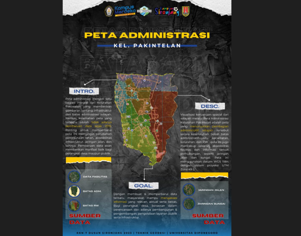
The administrative map has become a familiar and integrated element in the Pakintelan Village Office through its fairly thorough and structured presentation. The map comprehensively depicts the distribution of infrastructure/facilities as well as the administrative boundaries of the area concerned. However, the focus on refreshing map information has its limitations because the last map data update was carried out in 2015. Updating regional administrative maps is an aspect that is considered necessary, considering the multifaceted changes in various things such as changes in administrative areas at the RT level, development of facilities general and social, changes in road networks, differences in land use, and various other aspects.
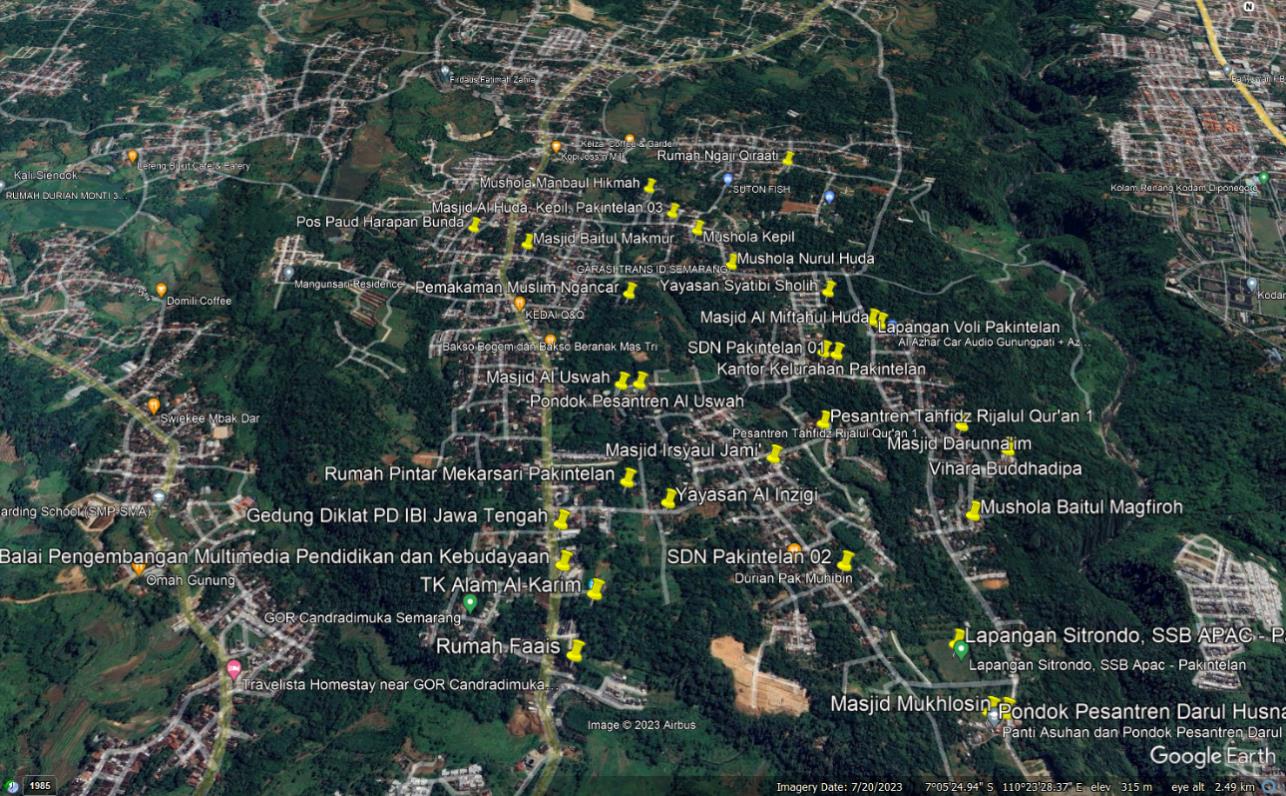

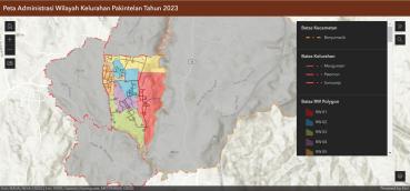
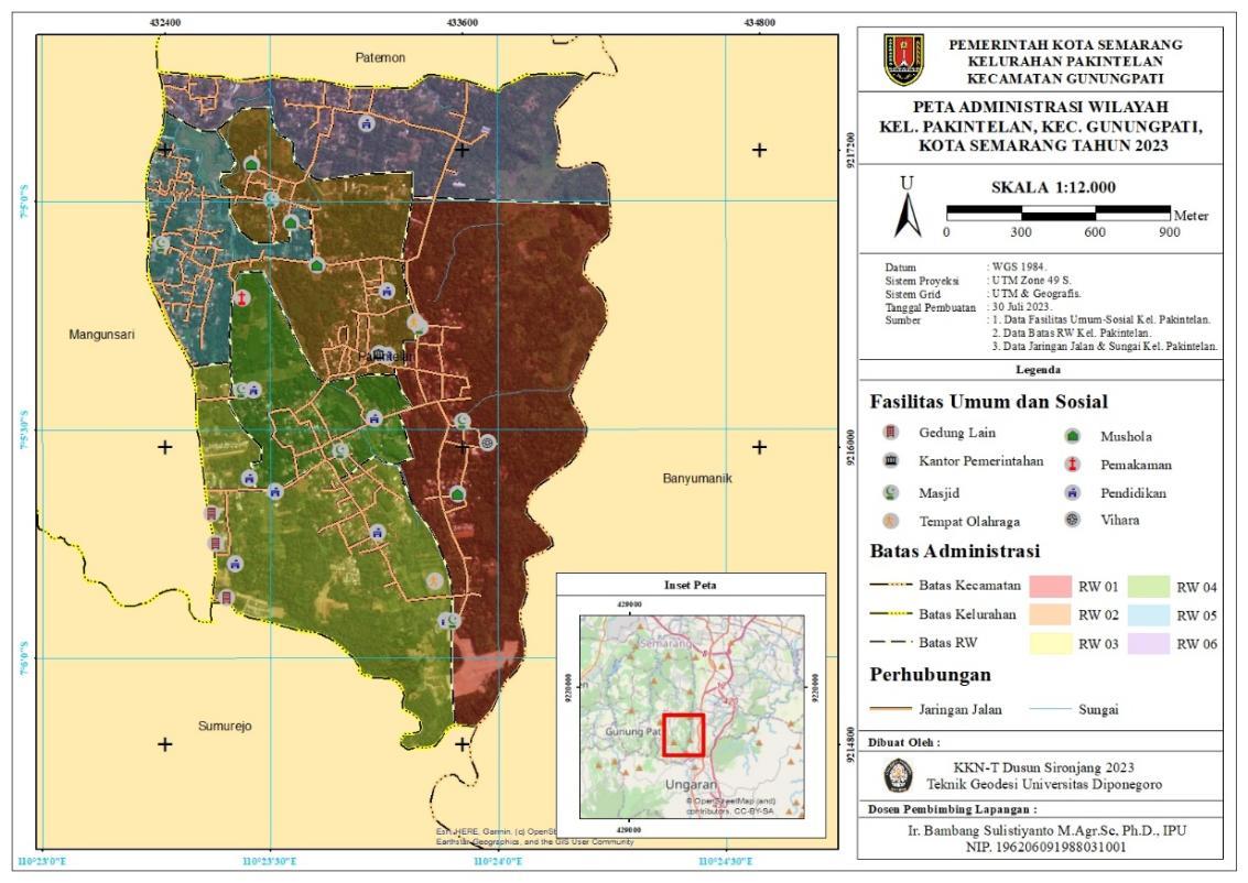
The Administrative Map of the Pakintelan Village Area is a spatial visualization that represents the administrative division of the entire Pakintelan Village area. Apart from containing information regarding administrative boundaries – sub-district boundaries, sub-district boundaries and RW boundaries – the map also includes the distribution of facility accessibility, both public facilities and social facilities. Information about transportation, such as road and river networks, is also one of the aspects contained in the map. During the implementation of the IDBU program activities from August to September 2023, a survey was carried out regarding the distribution of infrastructure in the form of public and social facilities, which can be seen on the map using the WGS 1984 datum with the UTM Zone 49 S projection system. The data used in making the projection system includes Semarang City Administrative Boundaries Data for 2023, Gunungpati District Administrative Data for 2023, Pakintelan Village Road Network Data for 2023, Pakintelan Village River Data and Public Facilities Data, and Pakintelan Village Social Affairs.
The Pakintelan Village Administration Map provides an accurate, complete, clear and thorough visual depiction of the administrative structure of the entire area in the Pakintelan Village. The creation of administrative maps by updating the latest data sources is also able to support transparency in government and ensure that information regarding regional administration is available to the general public and easily accessible freely to the public. For village and government officials, this map functions in regional development and development planning, regulating public services, managing the quality of infrastructure/facilities, and so on.


Author: Amanda Wijayanti—Geodetic Engineering Student, (Assisted Village Science and Technology) IDBU Program of Diponegoro University, 2023, Sironjang Sub-Village, Pakintelan Village, Gunungpati District, Semarang City.
DPL : Ir. Bambang Sulistiyanto, M.Agr.Sc., Ph.D., IPU.