


UNDIP, Senggi, Keerom Regency (2/8) – Efforts to accelerate the development and planning of the Senggi Transmigration Area (KT Senggi) in Keerom Regency, Papua, are continuing to be refined by Team 16 of the 2026 Universitas Diponegoro (UNDIP) Patriot Expedition, led by Dr. Sariffuddin, S.T., M.T. To produce accurate and highly precise regional mapping, the team is collaborating to capture aerial imagery using drone technology and the Global Navigation Satellite System (GNSS).
This innovative initiative reflects strong collaboration between Team 16 and Team 13 of the UNDIP Patriot Expedition in the field. The high-precision aerial mapping aims to provide a detailed representation of the area’s actual physical conditions as a key foundation for developing a regional spatial master plan.
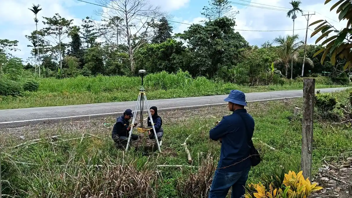
Head of Team 13 of the UNDIP Patriot Expedition, Dr. (cand.) Pangi, S.T., M.T., explained that aerial mapping and GNSS technology play a vital role in maintaining the accuracy of the area’s geospatial data, ensuring it remains aligned with its actual coordinates. “We use drones to capture aerial imagery and GNSS technology to establish Ground Check Points (GCPs), ensuring that the aerial images are accurate and do not shift from their reference points,” said Pangi, who is currently pursuing a doctoral degree in Urban Studies at UNDIP.
For this activity, the team deployed two drones and two GNSS devices. The two drones are being used to accelerate the mapping process and expand the coverage area. In contrast, the GNSS devices are used to determine ground control points that serve as positional references for the aerial imagery.
Pangi added that the independent aerial mapping was carried out to address the limited availability of high-quality satellite imagery in the border region. Existing commercial and open-source satellite imagery is considered insufficient for the study’s needs. “In fact, we can use open satellite imagery from sources such as ESRI, Google Earth, or Bing. However, Bing and ESRI satellite imagery is generally not up to date, while the satellite imagery from Google Earth in this area has relatively unclear visual quality,” he emphasized.
The technical workflow in the field begins with establishing a benchmark, determining GCP locations, designing drone flight paths, capturing aerial imagery, and processing the imagery. Mohammad Nursodiq, a member of Team 16 of the UNDIP Patriot Expedition and a drone pilot, highlighted the importance of ensuring equipment readiness before deployment. “Before the drone takes off, the team must ensure the technical readiness of all equipment and carry out the preprocessing procedures. This initial stage is crucial in determining the quality of the data we collect,” Nursodiq said.
The aerial mapping process is scheduled to be carried out in stages over a period of one to two months. The duration will depend on the extensive coverage of the Senggi Transmigration Area, challenging topographical conditions, and frequently changing local weather.
All aerial imagery and GNSS coordinates collected will subsequently be processed using photogrammetry software. The final outputs will include orthophoto maps and other spatial data depicting the actual conditions of the Senggi Transmigration Area. This integrated spatial dataset will serve as one of the foundations for the 2026 UNDIP Patriot Expedition Team to conduct studies and prepare more accurate, field-based recommendations for planning the Senggi Transmigration Area.
This collaborative initiative underscores UNDIP’s strategic role in supporting the achievement of the Sustainable Development Goals (SDGs), particularly SDG 9 (Industry, Innovation and Infrastructure) through the application of modern mapping technology; SDG 11 (Sustainable Cities and Communities) through structured spatial planning for the transmigration area; and SDG 17 (Partnerships for the Goals) through cross-team academic collaboration in regional development. (Public Communication/UNDIP)