
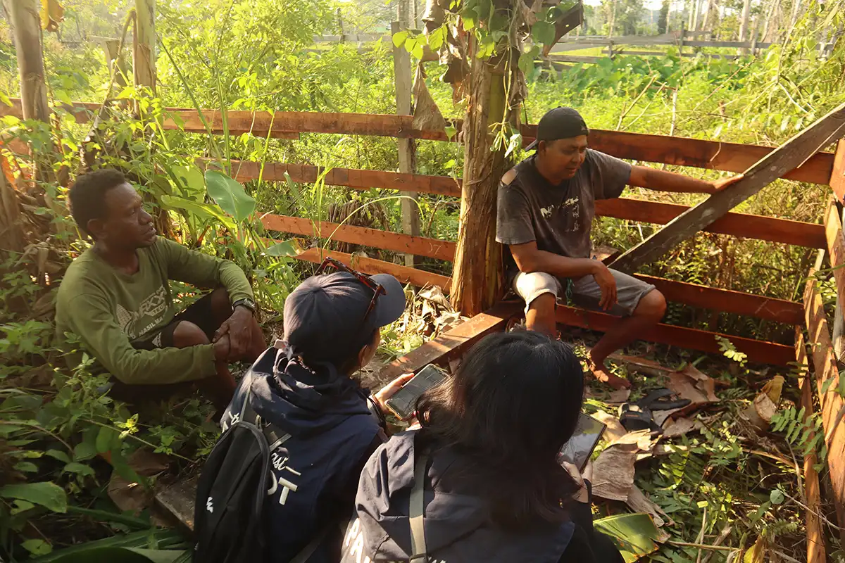
UNDIP, Senggi, Keerom Regency (7/9) – Team 19 of the Universitas Diponegoro (UNDIP) Patriot Expedition, led by Dr.Ing. Wakhidah Kurniawati, S.T., M.T., has been assisting residents of Woslay Village, Senggi District, Keerom Regency, Papua. Through engaging discussions and ground checking with residents, the team sought to map and better understand hydrometeorological disaster risks in the transmigration area.
The field data collection aimed to precisely validate disaster threats affecting residential areas, livestock farms, and agricultural land. Rather than relying solely on spatial maps, Team 19 of the UNDIP Patriot Expedition incorporated local knowledge to ensure disaster-prone areas were mapped accurately and comprehensively.
The field survey focused on two contrasting environmental challenges: flooding in residential areas and livestock farms during the rainy season, and drought affecting agricultural land during the dry season. Based on residents’ accounts and physical inspections, flooding is triggered by shallow drainage channels, waste blockages, and Senggi’s characteristic clay soil, which has limited capacity to absorb water quickly.
Flooding in livestock areas often causes material losses for residents. Deep mud can leave livestock partially submerged and unable to move, putting them at risk of weakness and death. The situation is exacerbated by Senggi’s clay soil, which becomes muddy when inundated. Sriyono, a Woslay Village resident who works as a farmer and livestock breeder, shared his experience dealing with the challenging soil conditions.
“The soil in Senggi is different. When cattle keep walking on the livestock area, especially during the rainy season, the ground becomes increasingly wet and turns into fairly deep mud. The soil here is clay, so when exposed to rainwater, it becomes soft and sticky more easily,” Sriyono said.
Amid these challenges, Team 19 of the UNDIP Patriot Expedition observed the resilience of Woslay Village residents as they adapted to climate uncertainty. To maintain agricultural productivity, farmers have adopted adaptive crop rotation, switching to corn during the dry season and returning to rice cultivation when the rainy season begins.
All primary data collected through ground checks, drainage channel analysis, soil characterization, and direct interactions with residents have been compiled into a comprehensive database. The data will serve as a basis for strategic recommendations for disaster mitigation planning and community-based environmental improvement in Senggi District.
This initiative demonstrates UNDIP’s commitment to realizing its tagline, “Noble and Valuable UNDIP,” by bringing academics directly to transmigration areas to strengthen community resilience to disaster risks. The disaster mapping and mitigation activities also contribute to the achievement of the Sustainable Development Goals (SDGs), particularly SDG 11 (Sustainable Cities and Communities) through reducing hydrometeorological disaster risks in residential areas; SDG 13 (Climate Action) through strengthening residents’ adaptive capacity and resilience to extreme weather events; and SDG 15 (Life on Land) through sustainable management and protection of agricultural land quality. (Public Communication/UNDIP)