

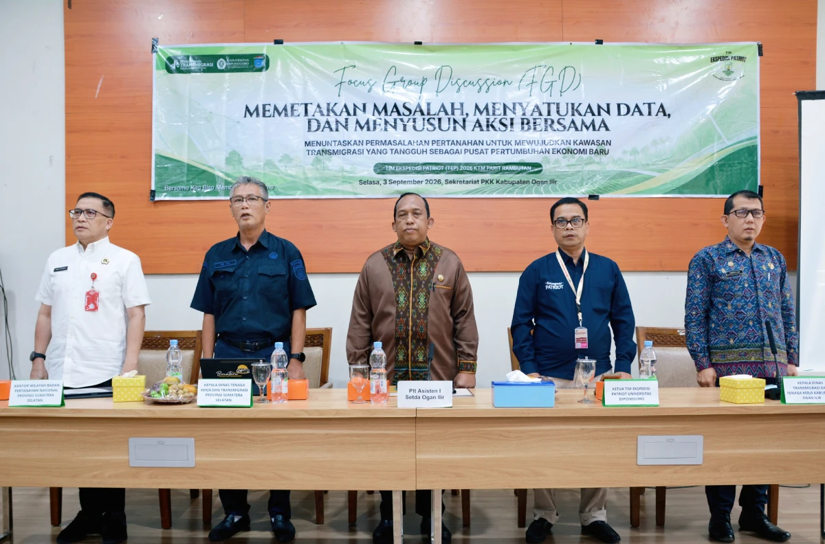
UNDIP, Ogan Ilir, South Sumatra (4/10) – Team 22 Parit Rambutan of the Universitas Diponegoro Patriot Expedition Team (TEP UNDIP) has taken concrete steps to map and resolve land-related issues in the Parit Rambutan Integrated Independent City (KTM) Area, Ogan Ilir Regency, South Sumatra. Through the first Focus Group Discussion (FGD) entitled “Mapping Problems, Integrating Data, and Formulating Joint Actions: Resolving Land Issues to Realize a Resilient Transmigration Area as a New Center of Economic Growth”, held on Thursday (3/9), TEP UNDIP facilitated data consolidation and cross-agency collaboration to ensure legal certainty and improve the welfare of transmigrant communities.
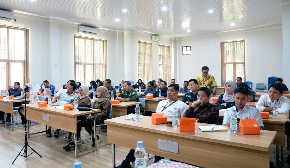
The activity, held at the Secretariat Building of the Ogan Ilir Regency Family Welfare Empowerment Team (PKK), was attended by approximately 50 participants representing the local government, land agencies, village administrations, and transmigrant communities from UPT 2/SP2 Sungai Rambutan and Tanjung Pule Village. The forum focused its discussions on accelerating land certification for residents, clarifying the area’s legal status, allocating approximately 300 hectares of Business Land 2 (LU-2), and ensuring consistency between land subject and object data.
Resolving land issues in transmigration areas requires commitment and transparency from all stakeholders. Head of the Ogan Ilir Regency Transmigration and Manpower Office, Dr. Amrullah, S.STP., M.Si., emphasized the importance of accelerating efforts to resolve long-standing disputes.
“Resolving land issues in Parit Rambutan is an important concern because they have continued for quite a long time. The Ogan Ilir Regency Government continues to encourage the acceleration of certificate issuance, including a proposal to issue 126 certificates, as well as completing the allocation of approximately 300 hectares of Business Land 2 (LU-2), which the community has been awaiting for a long time,” said Dr. Amrullah.
Assistant I for Government and People’s Welfare of Ogan Ilir Regency, Ibnu Hardi, S.Sos., M.Si., emphasized that the development of transmigration areas must go hand in hand with the protection of community rights and legal certainty over land. Data transparency and tracing the history of land tenure are important for ensuring that the resolution process is carried out systematically and in accordance with applicable regulations.
From the perspective of national regulations and technical mapping, a representative of the Ministry of Agrarian Affairs and Spatial Planning/National Land Agency (ATR/BPN), Dr. Andri Supriatna, S.T., M.Sc., explained that certainty over an area begins with certainty over individual land parcels. Therefore, mapping needs to be conducted using a bottom-up approach based on actual field conditions. Initial identification revealed several issues, including discrepancies between physical land possession and certificate data, informal transfers of land rights, and remaining land whose status has not yet been clearly defined.
Representatives of village governments in the assisted areas also conveyed community aspirations. Head of Sungai Rambutan Village, Willy A. Yani, explained the challenges residents have faced since their initial settlement. “Since the placement of transmigrants in 2008, residents of SP2 have not yet received land certificates. Only part of Business Land 1 (LU-1) has been distributed, while Business Land 2 (LU-2) has not yet been handed over. Accelerating certificate issuance and ensuring clarity in land allocation are the community’s primary expectations,” he said.
As a scientific solution, TEP UNDIP implemented a genealogical, legal, and spatial audit approach to comprehensively untangle the complex land issues—representative of the UNDIP Patriot Expedition Team, Dr.-Ing. Asnawi Manaf, S.T., presented the initial findings and the innovative methods applied.
“The genealogical, legal, and spatial audit approach is used to integrate administrative data, field conditions, the history of land tenure, and inter-agency policies. Initial findings indicate several issues requiring further verification, including the unrealized issuance of certificates for 126 prospective recipients (CPCL), the approximately 300 hectares of LU-2 that have yet to be distributed, and indications of land tenure issues that need to be investigated based on data and field evidence,” explained Dr.-Ing. Asnawi Manaf.
To improve mapping accuracy, TEP UNDIP applied the spider web mapping method, which traces land parcels by mapping one parcel and then examining its relationship with surrounding parcels to obtain a more comprehensive picture of ownership and tenure. Through the interactive discussion, FGD I formulated several concrete action plans as follow-up measures to resolve the problems, including:
- Conducting parcel-based IP4T/P4T inventory activities (Inventory of Land Tenure, Ownership, Use, and Utilization) using a bottom-up approach.
- Verifying community land parcel data.
- Providing spatial data through aerial photo mapping.
- Strengthening further coordination among the UNDIP Patriot Expedition Team, the Ogan Ilir Regency Government, the Ministry of ATR/BPN, and relevant government agencies.
Developing a database of land objects through IP4T is a crucial step before accelerating land certification and the development of the Parit Rambutan Integrated Independent City (KTM) Area. Through this program, TEP UNDIP makes a tangible contribution to improving the governance of transmigration areas, promoting legal certainty and enhancing the welfare of transmigrant communities in Ogan Ilir Regency.
The activity also supports the achievement of the Sustainable Development Goals (SDGs), particularly SDG 1 (No Poverty), SDG 10 (Reduced Inequalities), SDG 11 (Sustainable Cities and Communities), SDG 16 (Peace, Justice and Strong Institutions), and SDG 17 (Partnerships for the Goals), through strengthening land rights certainty, improving governance of transmigration areas, and promoting strategic cross-sector collaboration. (Public Communication/UNDIP)